
Đồng Nai Province topographic map
Interactive map
Click on the map to display elevation.
About this map
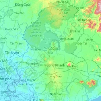
Name: Đồng Nai Province topographic map, elevation, terrain.
Location: Đồng Nai Province, Vietnam (10.57921 106.75117 11.58198 107.57785)
Average elevation: 109 m
Minimum elevation: -2 m
Maximum elevation: 1,166 m
Other topographic maps
Click on a map to view its topography, its elevation and its terrain.