
Burera District topographic map
Interactive map
Click on the map to display elevation.
About this map
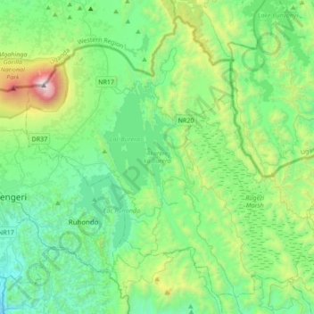
Name: Burera District topographic map, elevation, terrain.
Location: Burera District, Northern Province, Rwanda (-1.61170 29.65883 -1.30880 29.99875)
Average elevation: 2,059 m
Minimum elevation: 1,476 m
Maximum elevation: 4,084 m
Other topographic maps
Click on a map to view its topography, its elevation and its terrain.