
Make a donation
Kochi Prefecture topographic map
Click on the map to display elevation.
Make a donation
Kochi Prefecture
Kōchi Prefecture comprises the southwestern part of the island of Shikoku, facing the Pacific Ocean. It is bordered by Ehime to the north-west and Tokushima to the north-east. It is the largest but least populous of Shikoku's four prefectures. Most of the province is mountainous, and in only a few areas such as around Kōchi and Nakamura is there a coastal plain. Kōchi is famous for its many rivers. Inamura-yama in Tosa-cho is the highest peak in Kōchi prefecture with an altitude of 1,506 meters above sea level.
Make a donation
About this map
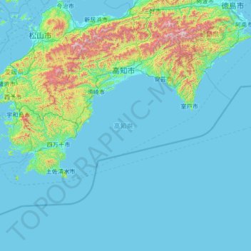
Name: Kochi Prefecture topographic map, elevation, terrain.
Location: Kochi Prefecture, Japan (32.38446 132.21266 33.88336 134.54238)
Average elevation: 155 m
Minimum elevation: -2 m
Maximum elevation: 1,883 m
Make a donation
Other topographic maps
Click on a map to view its topography, its elevation and its terrain.