
Gedong Meneng topographic map
Interactive map
Click on the map to display elevation.
About this map
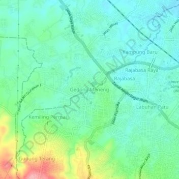
Name: Gedong Meneng topographic map, elevation, terrain.
Average elevation: 135 m
Minimum elevation: 99 m
Maximum elevation: 238 m
Other topographic maps
Click on a map to view its topography, its elevation and its terrain.
Jatimulyo
Indonesia > Lampung > Lampung Selatan
Jatimulyo, Lampung Selatan, Lampung, Sumatra, 35365, Indonesia
Average elevation: 81 m
Krakatoa
Indonesia > Lampung > Lampung Selatan
Krakatoa, Lampung Selatan, Lampung, Sumatra, Indonesia
Average elevation: 20 m