
Thank you for supporting this site ❤️
Make a donation
Make a donation
Renfrew topographic map
Click on the map to display elevation.
Thank you for supporting this site ❤️
Make a donation
Make a donation
About this map
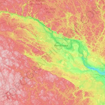
Name: Renfrew topographic map, elevation, terrain.
Location: Renfrew, Renfrew County, Est de l'Ontario, Ontario, Canada (45.03006 -77.97937 46.43006 -76.57937)
Average elevation: 280 m
Minimum elevation: 72 m
Maximum elevation: 561 m
Thank you for supporting this site ❤️
Make a donation
Make a donation
Other topographic maps
Click on a map to view its topography, its elevation and its terrain.
Lac du Rocher Fendu;Rivière des Outaouais
Canada > Ontario > Renfrew County > Whitewater Region
Average elevation: 94 m
Thank you for supporting this site ❤️
Make a donation
Make a donation