
Hessental topographic map
Interactive map
Click on the map to display elevation.
About this map
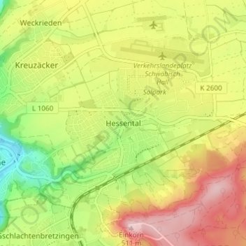
Name: Hessental topographic map, elevation, terrain.
Average elevation: 394 m
Minimum elevation: 279 m
Maximum elevation: 511 m
Stadtmitte | Nördliche Kernstadt | Kreuzäcker | Südliche Kernstadt | Tullauer Höhe / Hagenbach | Rollhof / Reifenhof | Stadtheide | Heimbachsiedlung / Teurershof | Steinbach | Hessental | Bibersfeld | Gailenkirchen | Gelbingen | Eltershofen | Sulzdorf | Tüngental | Weckrieden