
Thank you for supporting this site ❤️
Make a donation
Make a donation
Takungan topographic map
Click on the map to display elevation.
Thank you for supporting this site ❤️
Make a donation
Make a donation
About this map
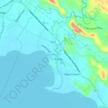
Name: Takungan topographic map, elevation, terrain.
Location: Takungan, Pililla, Rizal, Calabarzon, Philippines (14.46308 121.28591 14.50308 121.32591)
Average elevation: 16 m
Minimum elevation: 0 m
Maximum elevation: 117 m
Thank you for supporting this site ❤️
Make a donation
Make a donation