
Teutheuvel topographic map
Interactive map
Click on the map to display elevation.
About this map
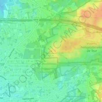
Name: Teutheuvel topographic map, elevation, terrain.
Location: Teutheuvel, Zonhoven, Hasselt, Limburg, Vlaanderen, 3520, België (51.00417 5.40028 51.00427 5.40038)
Average elevation: 56 m
Minimum elevation: 41 m
Maximum elevation: 78 m
Other topographic maps
Click on a map to view its topography, its elevation and its terrain.