
Aïn Zaatout topographic map
Interactive map
Click on the map to display elevation.
About this map
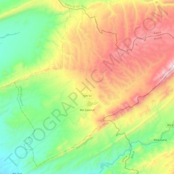
Name: Aïn Zaatout topographic map, elevation, terrain.
Location: Aïn Zaatout, Daïra El Kantara, Biskra, Algérie (35.08795 5.74519 35.25192 5.96611)
Average elevation: 956 m
Minimum elevation: 433 m
Maximum elevation: 1,740 m