
Glendale topographic map
Interactive map
Click on the map to display elevation.
About this map
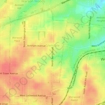
Name: Glendale topographic map, elevation, terrain.
Location: Glendale, Saint Louis County, Missouri, United States (38.58275 -90.39132 38.60530 -90.37226)
Average elevation: 179 m
Minimum elevation: 144 m
Maximum elevation: 201 m