
Thank you for supporting this site ❤️
Make a donation
Make a donation
Evening Shade topographic map
Click on the map to display elevation.
Thank you for supporting this site ❤️
Make a donation
Make a donation
About this map
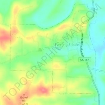
Name: Evening Shade topographic map, elevation, terrain.
Location: Evening Shade, Sharp County, Arkansas, United States (36.05723 -91.63739 36.08224 -91.60911)
Average elevation: 153 m
Minimum elevation: 125 m
Maximum elevation: 198 m
Thank you for supporting this site ❤️
Make a donation
Make a donation
Other topographic maps
Click on a map to view its topography, its elevation and its terrain.