
Blaine topographic map
Interactive map
Click on the map to display elevation.
About this map
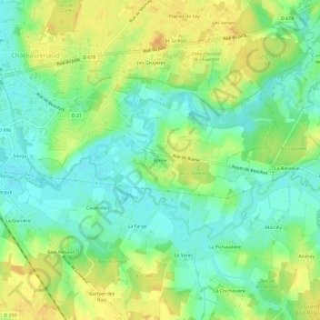
Name: Blaine topographic map, elevation, terrain.
Average elevation: 192 m
Minimum elevation: 177 m
Maximum elevation: 210 m
Other topographic maps
Click on a map to view its topography, its elevation and its terrain.
Beaulieu
France > Bourgogne-Franche-Comté > Saône-et-Loire > Louhans
Beaulieu, Châteaurenaud, Louhans, Saône-et-Loire, Bourgogne-Franche-Comté, France métropolitaine, 71500, France
Average elevation: 192 m
L'Écotet
France > Bourgogne-Franche-Comté > Saône-et-Loire > Louhans
L'Écotet, Châteaurenaud, Louhans, Saône-et-Loire, Bourgogne-Franche-Comté, France métropolitaine, 71500, France
Average elevation: 188 m