
Thank you for supporting this site ❤️
Make a donation
Make a donation
Bagnone topographic map
Click on the map to display elevation.
Thank you for supporting this site ❤️
Make a donation
Make a donation
Bagnone
Bagnone is a comune (municipality) in the Province of Massa and Carrara in the Italian region Tuscany, located about 120 kilometres (75 mi) northwest of Florence and about 35 kilometres (22 mi) northwest of Massa in the Lunigiana, facing the Monte Sillara, which has a peak elevation of 1,861 metres (6,106 ft). The communal territory is crossed by the Bagnone torrent, a left affluence of the Magra River.
Thank you for supporting this site ❤️
Make a donation
Make a donation
About this map
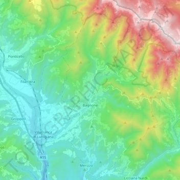
Name: Bagnone topographic map, elevation, terrain.
Average elevation: 568 m
Minimum elevation: 91 m
Maximum elevation: 1,841 m
Thank you for supporting this site ❤️
Make a donation
Make a donation