
Niederkassel topographic map
Interactive map
Click on the map to display elevation.
About this map
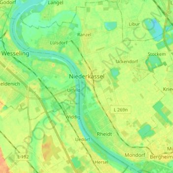
Name: Niederkassel topographic map, elevation, terrain.
Average elevation: 54 m
Minimum elevation: 41 m
Maximum elevation: 68 m
Other topographic maps
Click on a map to view its topography, its elevation and its terrain.
Ranzel
Deutschland > Nordrhein-Westfalen > Rhein-Sieg-Kreis > Niederkassel > Ranzel
Ranzel, Niederkassel, Rhein-Sieg-Kreis, Nordrhein-Westfalen, 53859, Deutschland
Average elevation: 53 m