
Thank you for supporting this site ❤️
Make a donation
Make a donation
Mirabel topographic map
Click on the map to display elevation.
Thank you for supporting this site ❤️
Make a donation
Make a donation
About this map
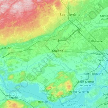
Name: Mirabel topographic map, elevation, terrain.
Location: Mirabel, La Rivière-du-Nord, Laurentides, Québec, Canada (45.44990 -74.27857 45.81760 -73.73015)
Average elevation: 94 m
Minimum elevation: 15 m
Maximum elevation: 400 m
Thank you for supporting this site ❤️
Make a donation
Make a donation
Other topographic maps
Click on a map to view its topography, its elevation and its terrain.
Thank you for supporting this site ❤️
Make a donation
Make a donation
Saint-Colomban
Canada > Québec > La Rivière-du-Nord > Saint-Colomban > Saint-Colomban
Average elevation: 162 m
Thank you for supporting this site ❤️
Make a donation
Make a donation