
Thank you for supporting this site ❤️
Make a donation
Make a donation
Serang topographic map
Click on the map to display elevation.
Thank you for supporting this site ❤️
Make a donation
Make a donation
About this map
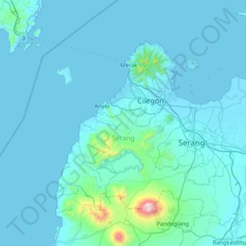
Name: Serang topographic map, elevation, terrain.
Location: Serang, Banten, Indonesia (-6.33577 105.82505 -5.80778 106.41189)
Average elevation: 79 m
Minimum elevation: -2 m
Maximum elevation: 1,758 m
Thank you for supporting this site ❤️
Make a donation
Make a donation