
Pontap topographic map
Interactive map
Click on the map to display elevation.
About this map
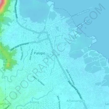
Name: Pontap topographic map, elevation, terrain.
Location: Pontap, Palopo, South Sulawesi, 91921, Indonesia (-3.02020 120.17761 -2.98020 120.21761)
Average elevation: 14 m
Minimum elevation: -1 m
Maximum elevation: 194 m
Other topographic maps
Click on a map to view its topography, its elevation and its terrain.
Palopo
Indonesia > South Sulawesi > Palopo
Palopo, South Sulawesi, 91921, Indonesia
Average elevation: 298 m