
East Holliston topographic map
Interactive map
Click on the map to display elevation.
About this map
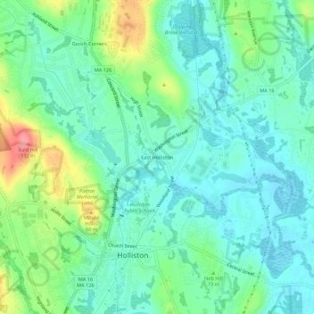
Name: East Holliston topographic map, elevation, terrain.
Average elevation: 67 m
Minimum elevation: 43 m
Maximum elevation: 131 m
Other topographic maps
Click on a map to view its topography, its elevation and its terrain.
Gooch Corners
United States > Massachusetts > Middlesex County > Holliston
Gooch Corners, Holliston, Middlesex County, Massachusetts, 01746, United States
Average elevation: 78 m