
大南岙村 topographic map
Interactive map
Click on the map to display elevation.
About this map
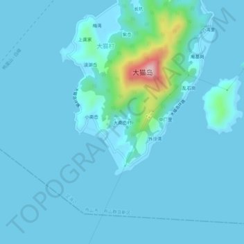
Name: 大南岙村 topographic map, elevation, terrain.
Location: 大南岙村, 舟山群岛新区, 定海区, 舟山市, 浙江省, 中国 (29.92122 122.01569 29.96122 122.05569)
Average elevation: 24 m
Minimum elevation: -1 m
Maximum elevation: 321 m
Other topographic maps
Click on a map to view its topography, its elevation and its terrain.