
滨海新区 topographic map
Interactive map
Click on the map to display elevation.
About this map
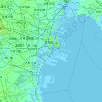
Name: 滨海新区 topographic map, elevation, terrain.
Location: 滨海新区, 天津市, 300450, Cina (38.43728 117.12920 39.33329 118.06000)
Average elevation: 2 m
Minimum elevation: -4 m
Maximum elevation: 17 m
Other topographic maps
Click on a map to view its topography, its elevation and its terrain.