
Le Crupet topographic map
Interactive map
Click on the map to display elevation.
About this map
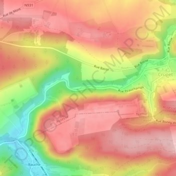
Name: Le Crupet topographic map, elevation, terrain.
Location: Le Crupet, Crupet, Assesse, Namen, Wallonië, 5332, België (50.33805 4.92420 50.35428 4.96171)
Average elevation: 222 m
Minimum elevation: 114 m
Maximum elevation: 285 m