
Schertz topographic map
Interactive map
Click on the map to display elevation.
About this map
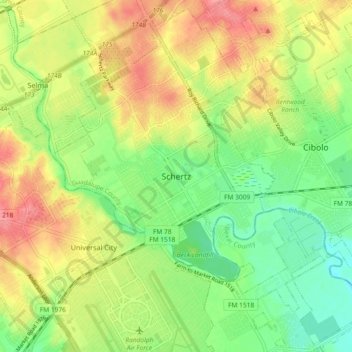
Name: Schertz topographic map, elevation, terrain.
Location: Schertz, Guadalupe County, Texas, 78154, United States (29.52416 -98.30957 29.60416 -98.22957)
Average elevation: 230 m
Minimum elevation: 194 m
Maximum elevation: 270 m