
Oberkrämer topographic map
Interactive map
Click on the map to display elevation.
About this map
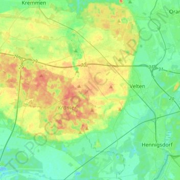
Name: Oberkrämer topographic map, elevation, terrain.
Location: Oberkrämer, Oberhavel, Brandenburg, 16727, Germany (52.60685 12.98178 52.76274 13.19430)
Average elevation: 42 m
Minimum elevation: 28 m
Maximum elevation: 65 m