
Pat Tsz Wo topographic map
Interactive map
Click on the map to display elevation.
About this map
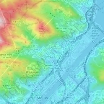
Name: Pat Tsz Wo topographic map, elevation, terrain.
Location: Pat Tsz Wo, Sha Tin District, Hong Kong, DD176 782, PRC (22.37905 114.17593 22.41905 114.21593)
Average elevation: 116 m
Minimum elevation: -4 m
Maximum elevation: 460 m