
Lowertown topographic map
Interactive map
Click on the map to display elevation.
About this map
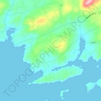
Name: Lowertown topographic map, elevation, terrain.
Location: Lowertown, West Cork, County Cork, Munster, Ireland (51.48314 -9.64389 51.53591 -9.58401)
Average elevation: 29 m
Minimum elevation: -3 m
Maximum elevation: 190 m
Other topographic maps
Click on a map to view its topography, its elevation and its terrain.