
Thank you for supporting this site ❤️
Make a donation
Make a donation
Frankston topographic map
Click on the map to display elevation.
Thank you for supporting this site ❤️
Make a donation
Make a donation
About this map
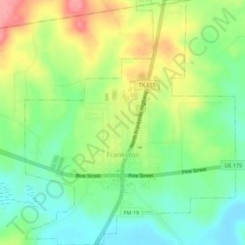
Name: Frankston topographic map, elevation, terrain.
Location: Frankston, Anderson County, Texas, United States (32.04221 -95.52145 32.07500 -95.48813)
Average elevation: 131 m
Minimum elevation: 92 m
Maximum elevation: 188 m
Thank you for supporting this site ❤️
Make a donation
Make a donation
Other topographic maps
Click on a map to view its topography, its elevation and its terrain.