
Walsberg topographic map
Interactive map
Click on the map to display elevation.
About this map
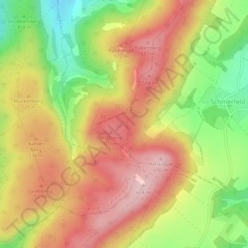
Name: Walsberg topographic map, elevation, terrain.
Location: Walsberg, Arnstadt, Ilm-Kreis, Thüringen, 99338, Deutschland (50.75356 10.92643 50.75366 10.92653)
Average elevation: 501 m
Minimum elevation: 373 m
Maximum elevation: 604 m