
岳城水库 topographic map
Interactive map
Click on the map to display elevation.
About this map
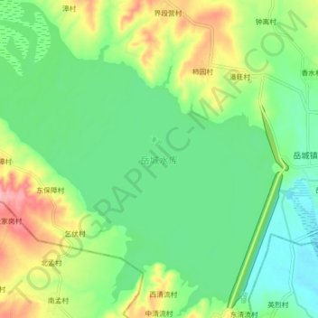
Name: 岳城水库 topographic map, elevation, terrain.
Location: 岳城水库, 磁县, 邯郸市, 殷都区, 安阳市, 河北省, 056500, 中国 (36.25416 114.12047 36.32253 114.20638)
Average elevation: 142 m
Minimum elevation: 98 m
Maximum elevation: 227 m