
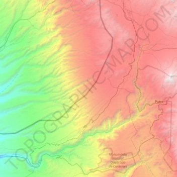
Río Lluta topographic map
Interactive map
Click on the map to display elevation.
About this map
Name: Río Lluta topographic map, elevation, terrain.
Average elevation: 2,652 m
Minimum elevation: 222 m
Maximum elevation: 5,829 m
Other topographic maps
Click on a map to view its topography, its elevation and its terrain.
Chinchorro
Chile > Región de Arica y Parinacota > Arica > Chinchorro
Chinchorro, Arica, Provincia de Arica, Región de Arica y Parinacota, 1020759, Chile
Average elevation: 24 m