
Eichberg topographic map
Interactive map
Click on the map to display elevation.
About this map
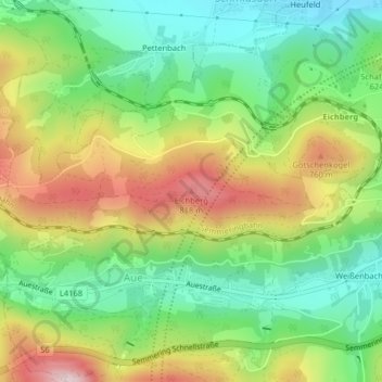
Name: Eichberg topographic map, elevation, terrain.
Average elevation: 612 m
Minimum elevation: 450 m
Maximum elevation: 849 m
Other topographic maps
Click on a map to view its topography, its elevation and its terrain.
Stuppach
Österreich > Niederösterreich > Bezirk Neunkirchen > Gemeinde Gloggnitz
Stuppach, Gemeinde Gloggnitz, Bezirk Neunkirchen, Niederösterreich, 2640, Österreich
Average elevation: 520 m