
Thank you for supporting this site ❤️
Make a donation
Make a donation
Angas topographic map
Click on the map to display elevation.
Thank you for supporting this site ❤️
Make a donation
Make a donation
About this map
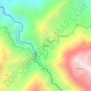
Name: Angas topographic map, elevation, terrain.
Location: Angas, Huigra, Alausí, Chimborazo, Ecuador (-2.35215 -79.06059 -2.31215 -79.02059)
Average elevation: 1,636 m
Minimum elevation: 927 m
Maximum elevation: 2,578 m
Thank you for supporting this site ❤️
Make a donation
Make a donation