
Dąbrowa Górnicza topographic map
Interactive map
Click on the map to display elevation.
About this map
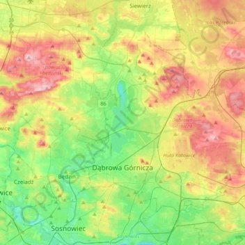
Name: Dąbrowa Górnicza topographic map, elevation, terrain.
Average elevation: 300 m
Minimum elevation: 233 m
Maximum elevation: 396 m
Other topographic maps
Click on a map to view its topography, its elevation and its terrain.
Racibórz
Poland > Silesian Voivodeship > Racibórz
Racibórz, Racibórz County, Silesian Voivodeship, Poland
Average elevation: 210 m
Żywiec
Poland > Silesian Voivodeship > Żywiec
Żywiec, powiat żywiecki, Silesian Voivodeship, Poland
Average elevation: 431 m
Katowice
Poland > Silesian Voivodeship > Katowice
Katowice, Górnośląsko-Zagłębiowska Metropolia, Silesian Voivodeship, Poland
Average elevation: 275 m