
Lac La Hache topographic map
Interactive map
Click on the map to display elevation.
About this map
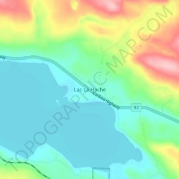
Name: Lac La Hache topographic map, elevation, terrain.
Average elevation: 847 m
Minimum elevation: 803 m
Maximum elevation: 958 m
Other topographic maps
Click on a map to view its topography, its elevation and its terrain.
Murphy Lake
Canada > British Columbia > Cariboo Regional District > Area G (Lac La Hache/108 Mile Ranch)
Murphy Lake, Area G (Lac La Hache/108 Mile Ranch), Cariboo Regional District, British Columbia, Canada
Average elevation: 912 m
Lac la Hache
Canada > British Columbia > Cariboo Regional District > Area G (Lac La Hache/108 Mile Ranch) > Wright
Lac la Hache, Wright, Area G (Lac La Hache/108 Mile Ranch), Cariboo Regional District, British Columbia, Canada
Average elevation: 918 m