
Kurzen Trechow topographic map
Interactive map
Click on the map to display elevation.
About this map
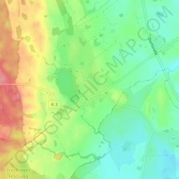
Name: Kurzen Trechow topographic map, elevation, terrain.
Average elevation: 46 m
Minimum elevation: 13 m
Maximum elevation: 101 m
Other topographic maps
Click on a map to view its topography, its elevation and its terrain.
Glambeck
Deutschland > Mecklenburg-Vorpommern > Landkreis Rostock > Bernitt
Glambeck, Bernitt, Bützow-Land, Landkreis Rostock, Mecklenburg-Vorpommern, Deutschland
Average elevation: 63 m