
North Crossett topographic map
Interactive map
Click on the map to display elevation.
About this map
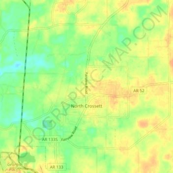
Name: North Crossett topographic map, elevation, terrain.
Location: North Crossett, Ashley County, Arkansas, United States (33.14221 -91.96875 33.20241 -91.90702)
Average elevation: 44 m
Minimum elevation: 27 m
Maximum elevation: 57 m
Other topographic maps
Click on a map to view its topography, its elevation and its terrain.
Wilmot
United States > Arkansas > Ashley County
Wilmot, Ashley County, Arkansas, United States
Average elevation: 36 m
Portland
United States > Arkansas > Ashley County
Portland, Ashley County, Arkansas, United States
Average elevation: 39 m
Crossett
United States > Arkansas > Ashley County > Crossett
Crossett, Ashley County, Arkansas, 71635, United States
Average elevation: 46 m
Wilmot
United States > Arkansas > Ashley County > Wilmot
Wilmot, Ashley County, Arkansas, 71676, United States
Average elevation: 36 m