
Parc du Bois-Beckett topographic map
Interactive map
Click on the map to display elevation.
About this map
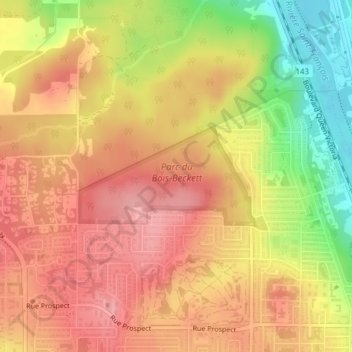
Name: Parc du Bois-Beckett topographic map, elevation, terrain.
Average elevation: 214 m
Minimum elevation: 139 m
Maximum elevation: 259 m
Other topographic maps
Click on a map to view its topography, its elevation and its terrain.
Lennoxville
Canada > Quebec > Sherbrooke
Lennoxville, Sherbrooke, Estrie, Quebec, Canada
Average elevation: 212 m
Huntingville
Canada > Quebec > Sherbrooke
Huntingville, Lennoxville, Sherbrooke, Estrie, Quebec, J1M 0C1, Canada
Average elevation: 176 m
Sherbrooke
Canada > Quebec > Sherbrooke
Sherbrooke, Estrie, Quebec, J1H 1P1, Canada
Average elevation: 249 m