
Thank you for supporting this site ❤️
Make a donation
Make a donation
Beycik topographic map
Click on the map to display elevation.
Thank you for supporting this site ❤️
Make a donation
Make a donation
Beycik
Beycik is situated in the Olympos National Park, in the foothills of Mount Olympos (2,400 m) and at an altitude of 450 m to 1,000 m. Noteworthy tourist attractions in the vicinity are Phaselis and Tekirova. The distance to the city of Antalya is 65 km and to the tourist town of Kemer is 22 km.
Thank you for supporting this site ❤️
Make a donation
Make a donation
About this map
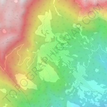
Name: Beycik topographic map, elevation, terrain.
Location: Beycik, Kemer, Antalya, Mediterranean Region, Turkey (36.48409 30.40463 36.52409 30.44463)
Average elevation: 995 m
Minimum elevation: 411 m
Maximum elevation: 1,776 m
Thank you for supporting this site ❤️
Make a donation
Make a donation