
Thank you for supporting this site ❤️
Make a donation
Make a donation
Mount Powell topographic map
Click on the map to display elevation.
Thank you for supporting this site ❤️
Make a donation
Make a donation
About this map
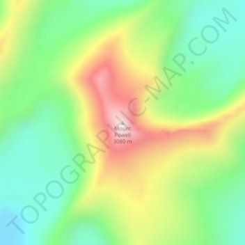
Name: Mount Powell topographic map, elevation, terrain.
Location: Mount Powell, Powell County, Montana, United States (46.35016 -112.97982 46.35026 -112.97972)
Average elevation: 2,677 m
Minimum elevation: 2,410 m
Maximum elevation: 3,094 m
Thank you for supporting this site ❤️
Make a donation
Make a donation
Other topographic maps
Click on a map to view its topography, its elevation and its terrain.