
临洮县 topographic map
Interactive map
Click on the map to display elevation.
About this map
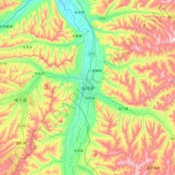
Name: 临洮县 topographic map, elevation, terrain.
Location: 临洮县, 洮阳镇, 临洮县, 定西市, 甘肃省, 中国 (35.23325 103.69692 35.55325 104.01692)
Average elevation: 2,112 m
Minimum elevation: 1,815 m
Maximum elevation: 2,519 m
Other topographic maps
Click on a map to view its topography, its elevation and its terrain.