
Sidi Boutouchent topographic map
Interactive map
Click on the map to display elevation.
About this map
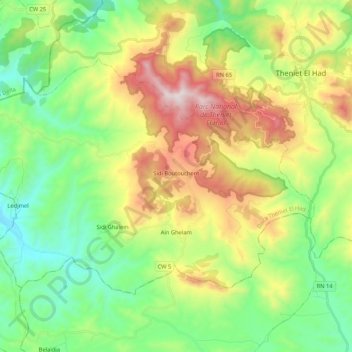
Name: Sidi Boutouchent topographic map, elevation, terrain.
Location: Sidi Boutouchent, Daïra Theniet El Had, Tissemsilt, Algérie (35.76632 1.82114 35.88106 2.03214)
Average elevation: 1,077 m
Minimum elevation: 693 m
Maximum elevation: 1,778 m
Other topographic maps
Click on a map to view its topography, its elevation and its terrain.
Theniet El Had
Algérie > Tissemsilt > Daïra Theniet El Had
Theniet El Had, Daïra Theniet El Had, Tissemsilt, 38200, Algérie
Average elevation: 1,017 m
Parc National de Theniet El Had
Algérie > Tissemsilt > Daïra Theniet El Had > Theniet El Had
Parc National de Theniet El Had, Theniet El Had, Daïra Theniet El Had, Tissemsilt, Algérie
Average elevation: 1,293 m