
Smithfield topographic map
Interactive map
Click on the map to display elevation.
About this map
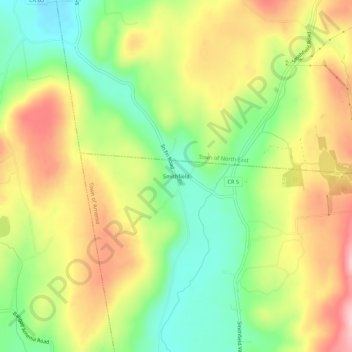
Name: Smithfield topographic map, elevation, terrain.
Average elevation: 297 m
Minimum elevation: 204 m
Maximum elevation: 400 m
Other topographic maps
Click on a map to view its topography, its elevation and its terrain.
Leedsville
United States > New York > Dutchess County > Town of Amenia
Leedsville, Town of Amenia, Dutchess County, New York, 12501, United States
Average elevation: 191 m
South Amenia
United States > New York > Dutchess County > Town of Amenia
South Amenia, Town of Amenia, Dutchess County, New York, 12592, United States
Average elevation: 186 m