
Isla Laitec topographic map
Interactive map
Click on the map to display elevation.
About this map
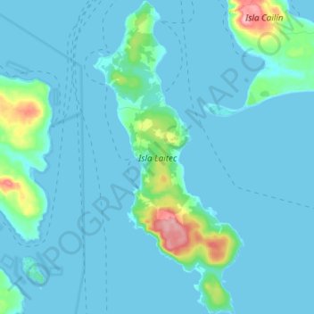
Name: Isla Laitec topographic map, elevation, terrain.
Average elevation: 13 m
Minimum elevation: -1 m
Maximum elevation: 137 m
Other topographic maps
Click on a map to view its topography, its elevation and its terrain.
Isla San Pedro
Chile > Región de Los Lagos > Quellón
Isla San Pedro, Quellón, Provincia de Chiloé, Región de Los Lagos, Chile
Average elevation: 90 m