
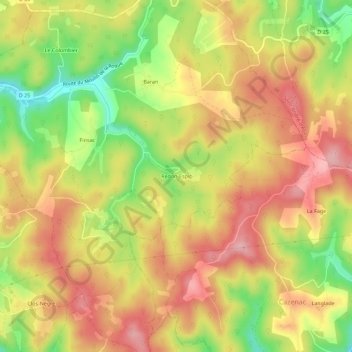
Redon-Espic topographic map
Interactive map
Click on the map to display elevation.
About this map
Name: Redon-Espic topographic map, elevation, terrain.
Average elevation: 213 m
Minimum elevation: 116 m
Maximum elevation: 286 m
Other topographic maps
Click on a map to view its topography, its elevation and its terrain.
Castels
France > Nouvelle-Aquitaine > Dordogne > Castels et Bézenac
Castels, Castels et Bézenac, Sarlat-la-Canéda, Dordogne, Nouvelle-Aquitaine, France métropolitaine, 24220, France
Average elevation: 166 m
Bézenac
France > Nouvelle-Aquitaine > Dordogne > Castels et Bézenac
Bézenac, Castels et Bézenac, Sarlat-la-Canéda, Dordogne, Nouvelle-Aquitaine, France métropolitaine, 24220, France
Average elevation: 149 m