
Thank you for supporting this site ❤️
Make a donation
Make a donation
Hun topographic map
Click on the map to display elevation.
Thank you for supporting this site ❤️
Make a donation
Make a donation
Hun
Le hameau de Hun est blotti entre la Meuse et les rochers escarpés qui le surplombent le long de la route Namur-Dinant. Son relief est très dénivelé, son altitude variant entre 85 m et 180 m.
Thank you for supporting this site ❤️
Make a donation
Make a donation
About this map
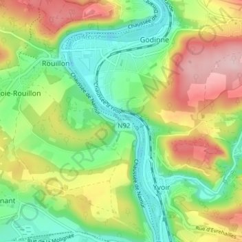
Name: Hun topographic map, elevation, terrain.
Average elevation: 160 m
Minimum elevation: 74 m
Maximum elevation: 287 m
Thank you for supporting this site ❤️
Make a donation
Make a donation