
Monceau-sur-Sambre topographic map
Interactive map
Click on the map to display elevation.
About this map
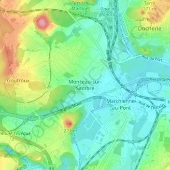
Name: Monceau-sur-Sambre topographic map, elevation, terrain.
Location: Monceau-sur-Sambre, Charleroi, Hainaut, Wallonie, 6031, Belgique (50.39702 4.36240 50.43702 4.40240)
Average elevation: 133 m
Minimum elevation: 97 m
Maximum elevation: 214 m