
迭部县 topographic map
Interactive map
Click on the map to display elevation.
About this map
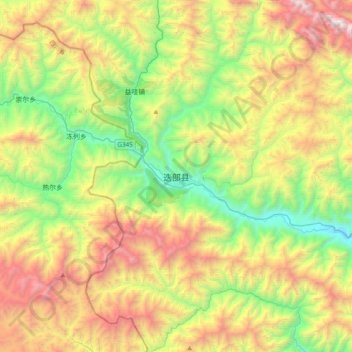
Name: 迭部县 topographic map, elevation, terrain.
Location: 迭部县, 电尕镇, 迭部县, 甘南藏族自治州, 甘肃省, 中国 (33.90053 103.05573 34.22053 103.37573)
Average elevation: 3,211 m
Minimum elevation: 2,207 m
Maximum elevation: 4,764 m
Other topographic maps
Click on a map to view its topography, its elevation and its terrain.