
Kartal topographic map
Interactive map
Click on the map to display elevation.
About this map
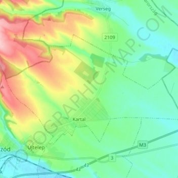
Name: Kartal topographic map, elevation, terrain.
Location: Kartal, Aszódi járás, Pest, Central Hungary, 2173, Hungary (47.65567 19.47768 47.70968 19.60768)
Average elevation: 164 m
Minimum elevation: 121 m
Maximum elevation: 263 m