
Raguhn-Jeßnitz topographic map
Interactive map
Click on the map to display elevation.
About this map
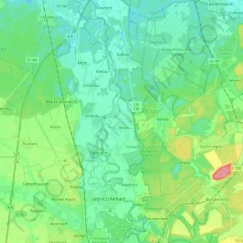
Name: Raguhn-Jeßnitz topographic map, elevation, terrain.
Location: Raguhn-Jeßnitz, Anhalt-Bitterfeld, Sachsen-Anhalt, Deutschland (51.65704 12.16511 51.80008 12.38977)
Average elevation: 79 m
Minimum elevation: 58 m
Maximum elevation: 141 m
Other topographic maps
Click on a map to view its topography, its elevation and its terrain.
Schierau
Deutschland > Sachsen-Anhalt > Raguhn-Jeßnitz
Schierau, Raguhn-Jeßnitz, Anhalt-Bitterfeld, Sachsen-Anhalt, Deutschland
Average elevation: 73 m