
La Bonita topographic map
Interactive map
Click on the map to display elevation.
About this map
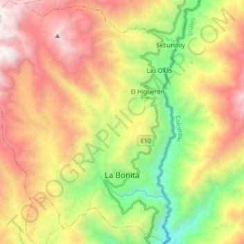
Name: La Bonita topographic map, elevation, terrain.
Location: La Bonita, Sucumbíos, Ecuador (0.43434 -77.62308 0.57098 -77.51553)
Average elevation: 2,538 m
Minimum elevation: 1,158 m
Maximum elevation: 4,102 m
Other topographic maps
Click on a map to view its topography, its elevation and its terrain.
El Playón de San Francisco
Ecuador > Sucumbíos > Sucumbíos
El Playón de San Francisco, Sucumbíos, Ecuador
Average elevation: 2,856 m