
Le Bourg topographic map
Interactive map
Click on the map to display elevation.
About this map
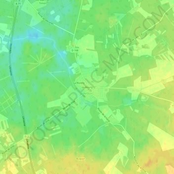
Name: Le Bourg topographic map, elevation, terrain.
Average elevation: 110 m
Minimum elevation: 96 m
Maximum elevation: 121 m
Other topographic maps
Click on a map to view its topography, its elevation and its terrain.
La Rivière
France > Centre-Val de Loire > Loiret > Ardon
La Rivière, Ardon, Orléans, Loiret, Centre-Val de Loire, France métropolitaine, 45160, France
Average elevation: 110 m